
As I sit here writing on this Father’s Day I’m thinking back to my early childhood, and the hikes I took with my father. From a young age I was taught to enjoy the outdoors; to hike, take in the sights, sounds, and smells of the Colorado mountain woods that I called home. From my backdoor I had nearly immediate access to Rocky Mountain National Park, and I quickly found that I preferred certain routes. Even as a teenager with a truck when I had greater access to trail heads, I preferred to hike in Wild Basin.
I now make my home in Alaska’s Chugach Mountains and the town of Eagle River. Much like my childhood home in Allenspark, Colorado, I enjoy near-immediate access to world class hiking and backcountry adventures. Also much like my earlier years, I am finding that one or two trailheads are my go to spots for my hikes. These days, the South Fork Eagle River Trail Head sees most of my visits, for several reasons. The trail provides quick access to alpine cirques, has plenty of water, and offers a variety of grass-roots spurs to the ridge lines surrounding the valley. An added bonus is that, even on days when the parking lot is full, I feel as though I have the wilderness all to myself.
To reach the South Fork trailhead take the Hiland Road exit from the Glen Highway Scenic Byway, and at the stoplight turn to the south to follow Hiland Road approximately 7 miles. You will be driving through what is essentially a neighborhood along the way, so please watch your speed and be on the lookout for kids, dogs, moose, or even bear. I’ve come across all of them on my frequent trips out here. Make sure you keep your eye out for the signs marking the trailhead, it can be easy to miss if you are not paying attention to signs, which is easy to do in this beautiful valley.
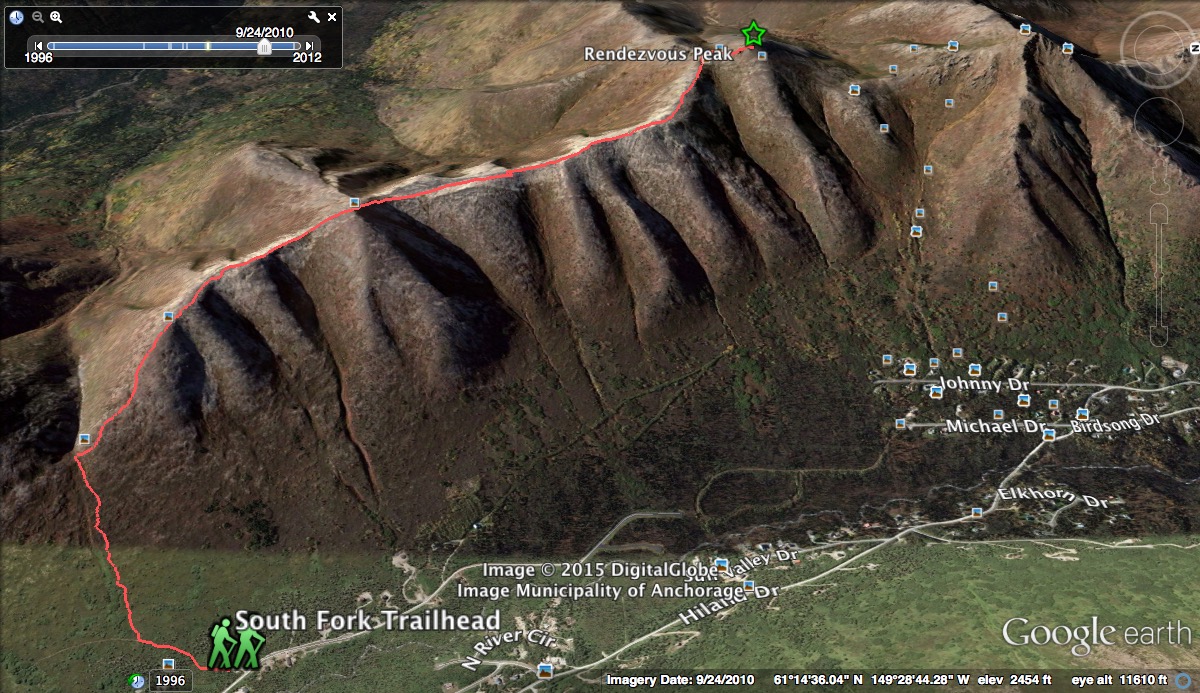
Google Earth screen capture the trail to Rendezvous Ridge.
The parking lot at the trailhead is somewhat small, and it is not uncommon to find cars parked along the road near the trailhead. Again, this trailhead is in a neighborhood, so please be courteous to those who live here. If you should find the parking lot full, don’t get the idea that the valley will be full of people. It is my experience, and that of others, that you will have the valley largely to yourself.
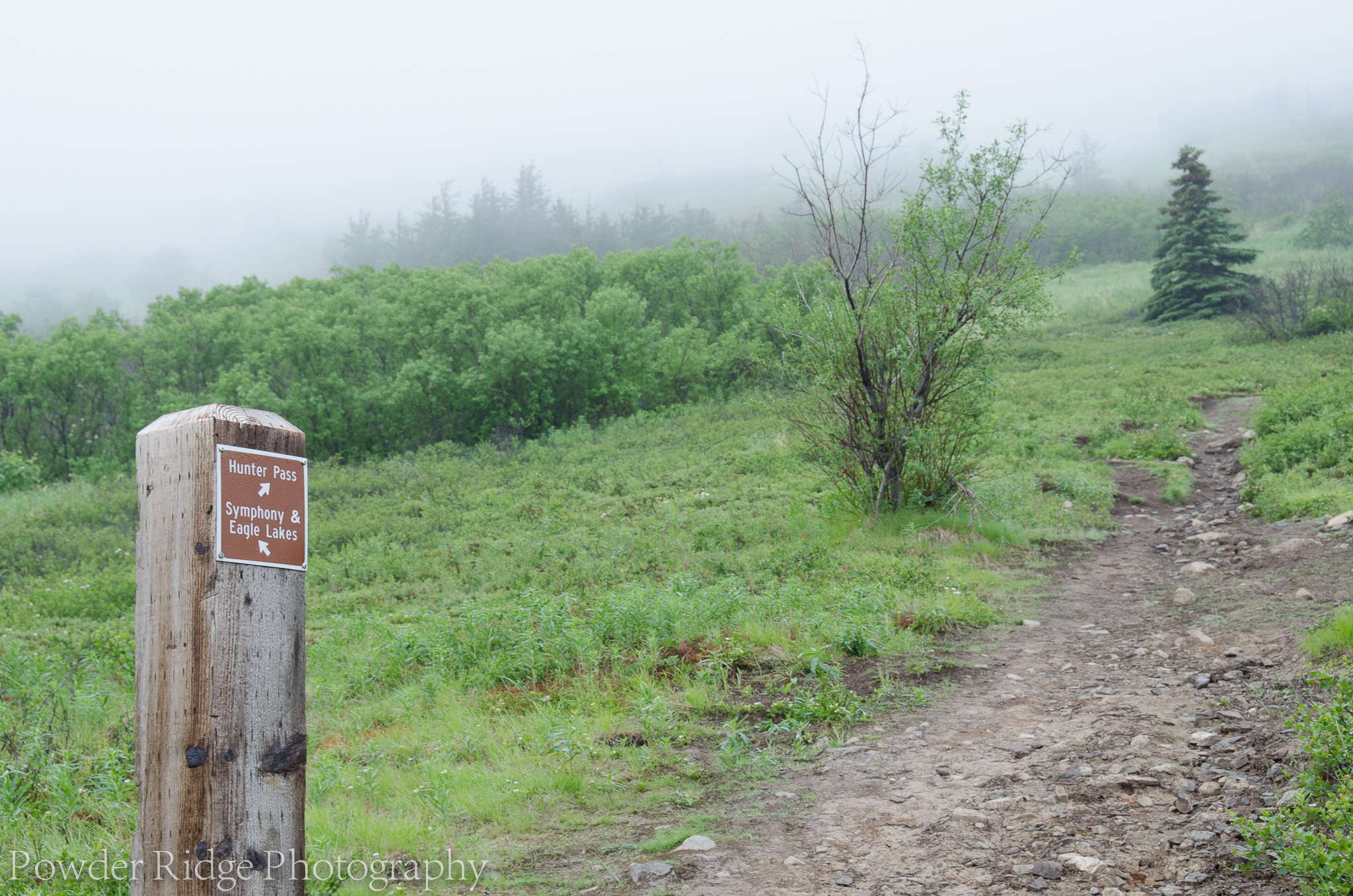
Marker post for the Hunter’s Pass spur trail.
Last week I enjoyed a sun-drenched hike to Hanging Valley, and on the return trip I started to eye the mountain peaks of Hiland, Gordon Lyon, and Rendezvous on the north-west valley ridge. This week I once again found myself at the familiar trailhead, but in much different weather. Where last week I was breaking a sweat in the 80 degree heat, today the weather had me wondering if I would need a jacket on the ridge line. A thick marine layer had moved into the valley during the early morning hours, pushing the cloud deck down to 2,500 feet or so. I did not know if the ridge top would be above the clouds or not, but I was certainly hoping so. Either way, there was no stopping me, I was determined to hike to Rendezvous Peak from Hunter’s Pass, make my way to Mt. Gordon Lyon, then scramble to Hiland Mountain before making my way down a ridge on the north side the Fort Richardson artillery range. This was all new territory to me, but I knew that with at least some visibility, I should be able to navigate the route.
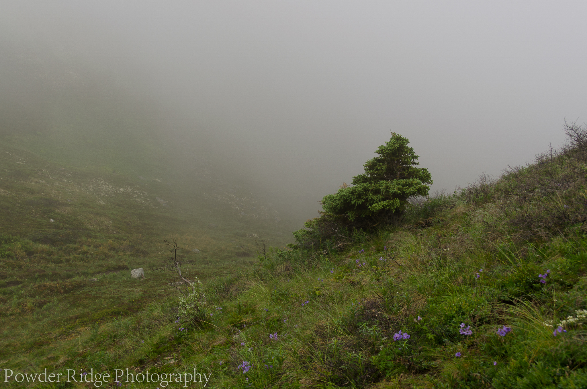
Hunters Pass
Like so many hikes in the South Fork Valley, accessing Rendezvous Ridge is done from a grass-roots spur off the main trail. In years past, the route was not marked, but a year or so ago trail crews placed marker posts for the more-established of these trails, such as that up to Hunter’s Pass. The branch to Hunter’s Pass is just a half-mile or so from the main trailhead, and quickly ascends up to the pass, without a switchback or anything else to get in the way, or save your lungs and legs. Hunter’s Pass is part of Rendezvous Ridge, which runs nearly the length of the South Fork Valley. If you want to hike the whole ridge line, I would suggest staying on the main South Fork trail until you encounter the marker post for Rendezvous Ridge, about 3 miles or so in. Once you reach the ridge top, hike north until you descend to Hunter’s Pass. From there, you can easily hike down to the trail head, or continue back up out of the pass and hike to Rendezvous Peak.
The trails up Rendezvous Ridge to the north and to the south are both very easy to find once you reach the saddle of Hunter’s Pass, if your destination is Rendezvous Peak, or Arctic Valley, then you will want to take the path to the north. The scramble up to the top of the ridge is similar to that coming up to the pass from the main trail, but with a few leg-saving switchbacks, less alder, and increasingly more tundra.
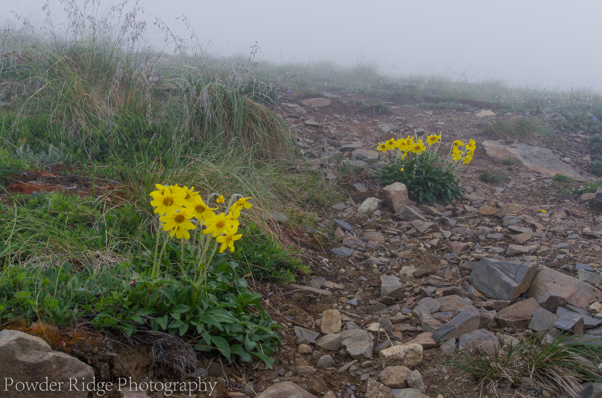
Alpine Arnica form into yellow beacons, seemingly marking the way ahead.
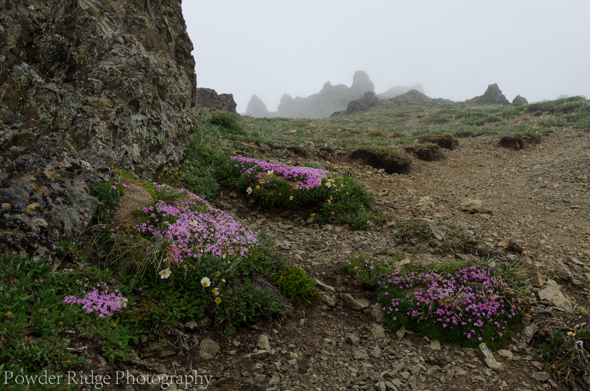
Late June in Alaska’s Chugach Mountains brings an explosion of color as the wildflowers of the alpine tundra come into full bloom. It is as if they know how short their season is, and they are intent on showing off their full beauty in the most vibrant of colors. Today’s hike would be one where the scenery would not be in the form of expansive views and landscapes, the clouds keeping my focus on the wildflowers lining the path. White mountain Aven, lavender wild Geranium, blue bells, purple Harebells, and neon-pink moss Campione were all in full bloom. Adding to the show was the positively intoxicating aroma that accompanied them.
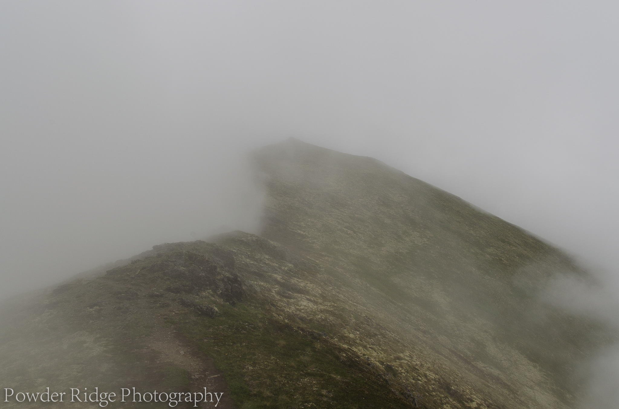
For a moment in time, a cloud bank is held back by Rendezvous Ridge.
At just over one hour I made my way to the ridge line, and I was completely enveloped in the clouds. Visibility ranged from 20 to 40 feet, and there was not any sign that the clouds would break anytime soon. It was not in the least bit breezy, and the mist of the clouds was oddly warm. The trail was very easy to pick out, as it was well worn. I checked my compass from time to time to make sure I was generally headed in the right direction, but without any land marks, my map was useless. Still I continued on, knowing that my reviews of the satellite imagery the night before confirmed little chance of losing my way if I stayed on the ridge top. It was not long before I found out just how wrong that assertion was.
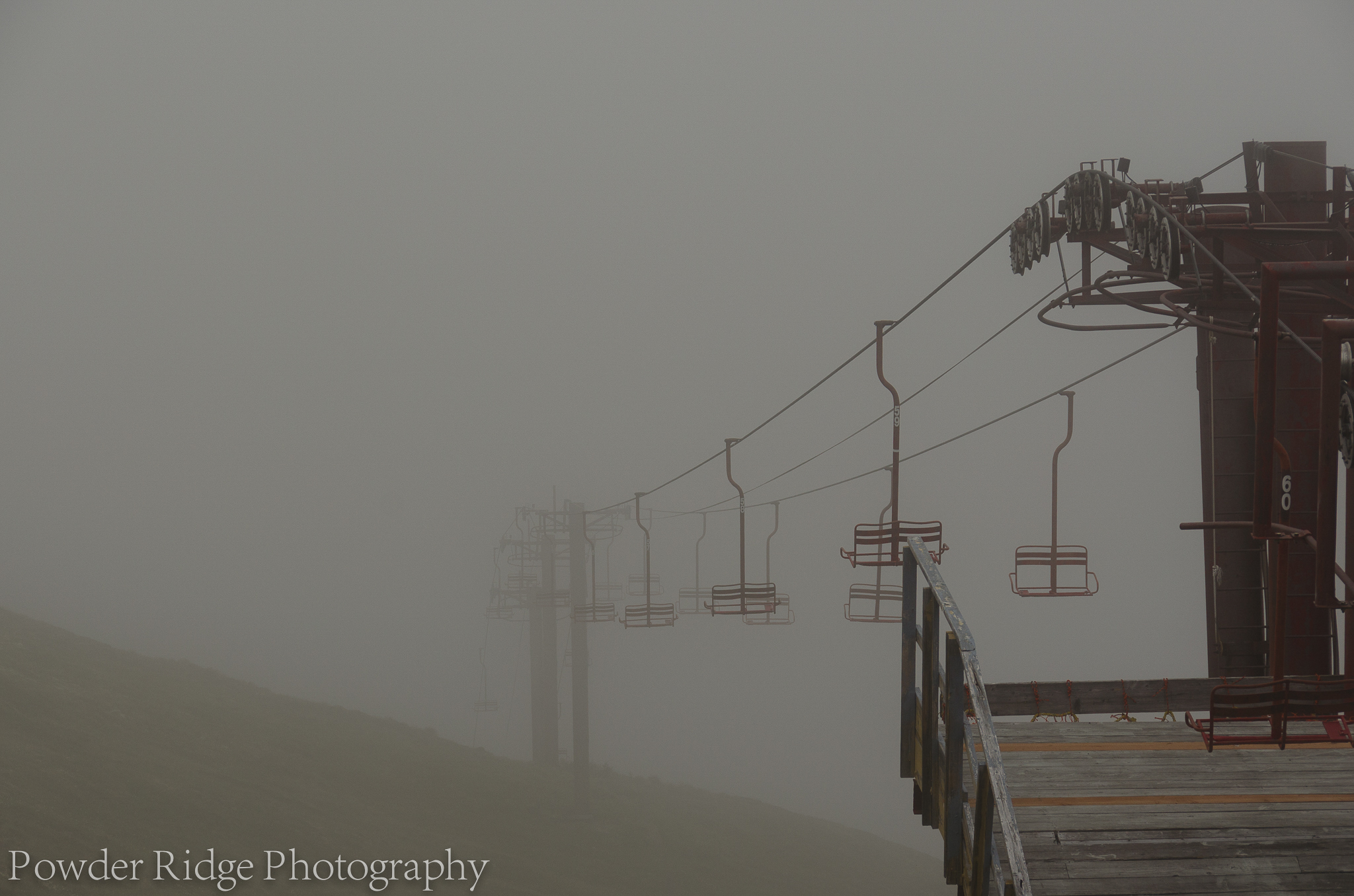
Bright red chairs of a chair lift at Arctic Valley hold a quiet vigil in the mist, waiting for the snows of winer to again bring them life.
During a brief period of good visibility, I saw one of the chair lifts of Arctic Valley up ahead of me. For some reason, my mind was convinced that the lifts should have been in a different place, and despite that not being so, my mind would not let go. I was, in a word, disoriented. I started to wonder if this was the same feeling that pilots get when flying through the clouds and losing track of up vs down, and not being able to trust what their instruments are telling them. It was not a comforting feeling, so I took a break on the lift platform and gathered my bearings.
Moss Campione lining the final scramble up to Rendezvous Peak.
I was eventually able to spot Rendezvous Peak through the mist, made my way up there, and took a two-hour nap on a bed of tundra. In a rare moment of wisdom, I decided that it was not a good idea to make my way on to Mt. Gordon Lyon, let alone Hiland or the ridge line down from there. Perhaps, if I was familiar with the route I would, but not today.

A ptarmigan stands quietly in the misty tundra.
The flowers of the alpine tundra where not the only things that stood out on this hike. Despite the thick cloud cover, I found myself to be frequently visited by all manner of wild birds. Finches, sparrows, magpies and even ptarmigan. On my hike down from the peak, along the ridge, and back to the valley floor I caught myself smiling, more than once. I often do that as I hike, but today I found myself to be especially enjoying being out in nature. While I did not richly ultimate destination, I was richly rewarded with an incredible experience in pure mountain solitude. Yet another reinforcement for the South Fork Valley as my go to destination.

Pingback: Climbing Hiland Mountain, Eagle River, Alaska | Powder Ridge Photography·